
Everything a seat-back map shows, on your phone
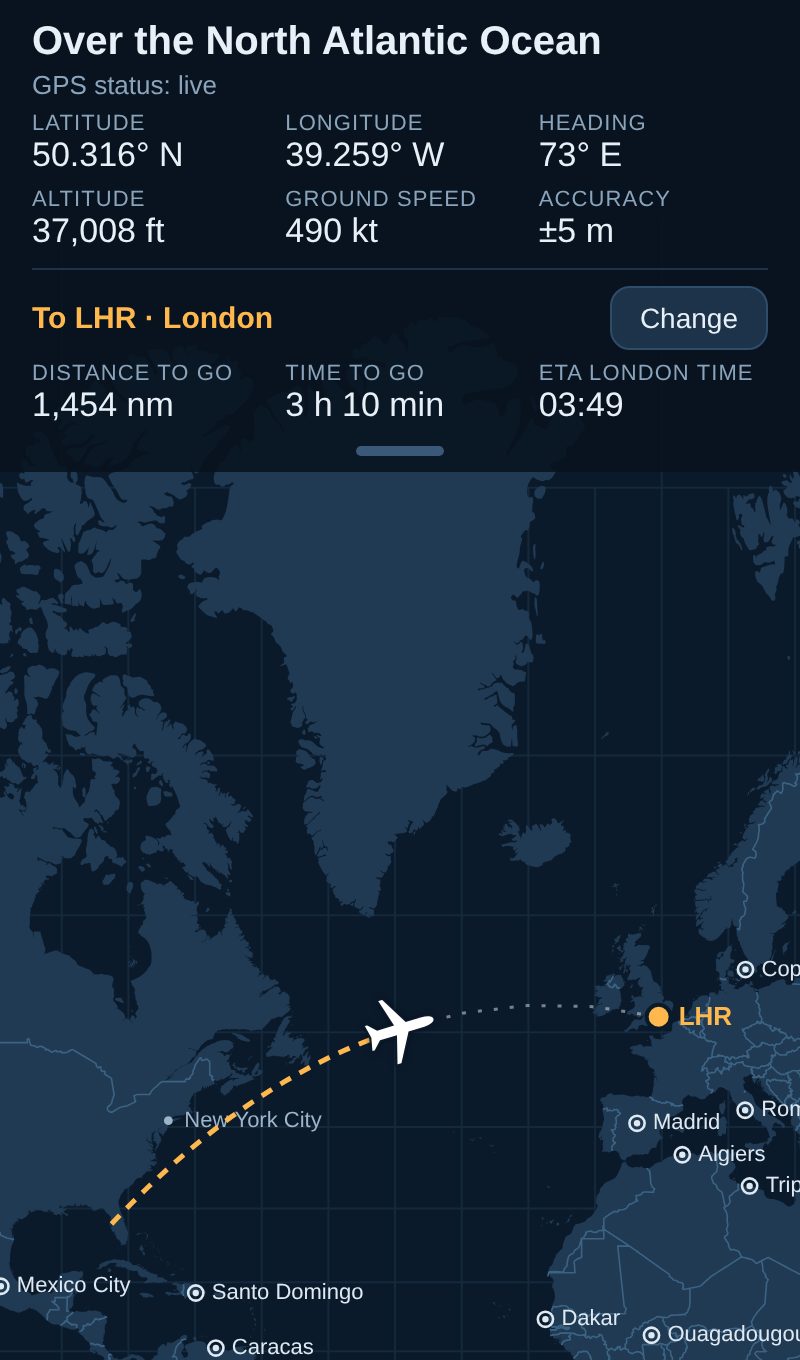
Where you are, live
Your plane on a world map, the country or sea below you, height, ground speed and heading. Set your arrival airport for distance and time to go, and your arrival time in the airport's local time. It keeps recording in the background with the screen off.
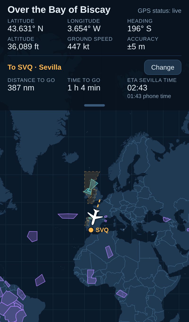
Turbulence and weather
Published turbulence, storm, mountain-wave and volcanic-ash warnings for the whole world, and the weather at your arrival airport. Download them before you board; they're shown in flight mode. Tap an area for its details.
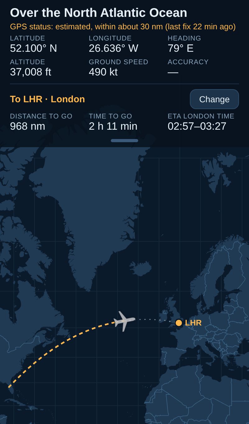
Honest when the GPS drops out
If the GPS loses the sky for a while, the app estimates where you are along the route and says so: "estimated, within about 30 nm", with the arrival time as a range. As soon as the GPS is back, it shows the real position.
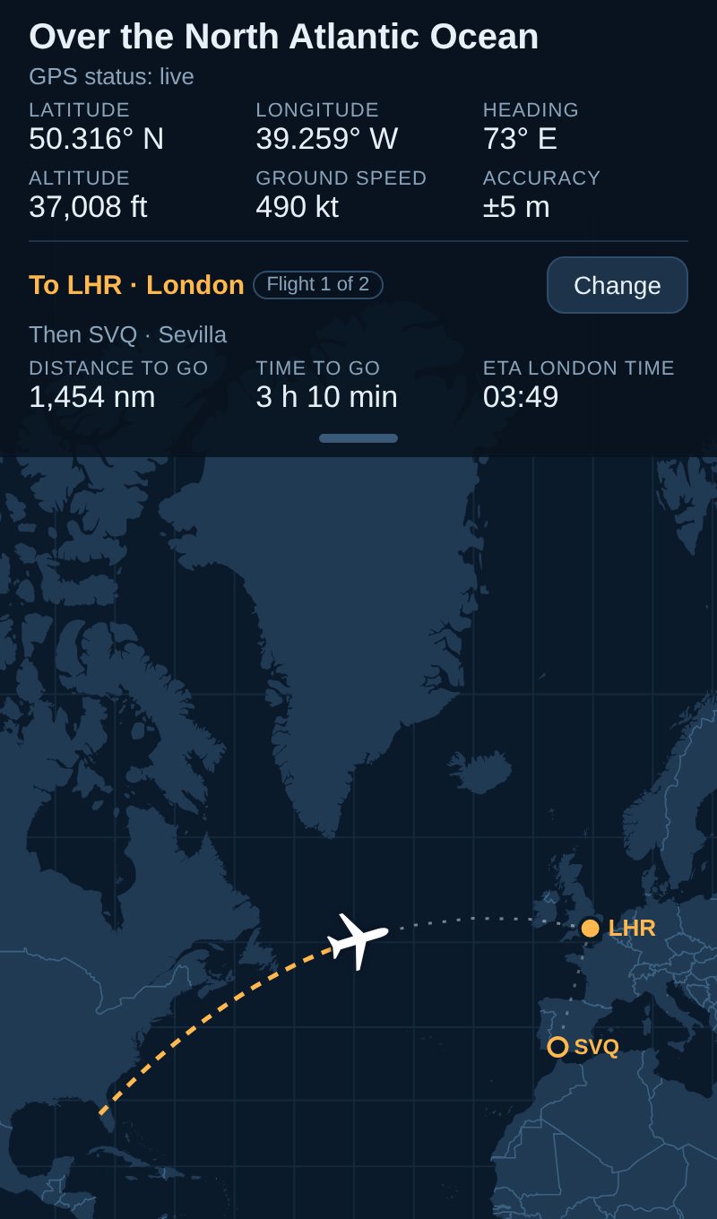
Trips with connections Unlimited
Plan the whole trip, layovers included. After each landing it waits at the airport and carries on with the next flight by itself.
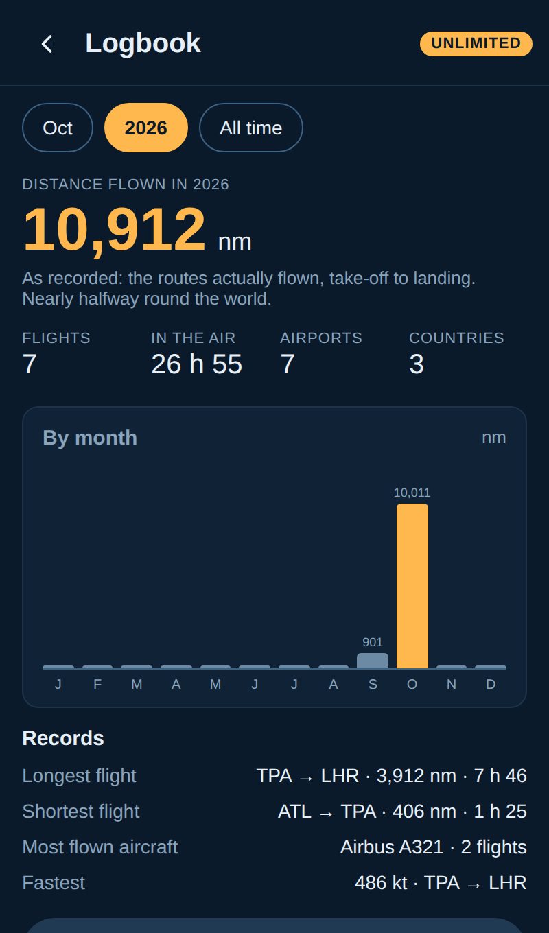
A logbook that fills itself in Pro
Every flight added when you land: the distance actually flown, time in the air, highest and fastest, and records by month and year. Add the flight number, aircraft and seat, and export to a spreadsheet.
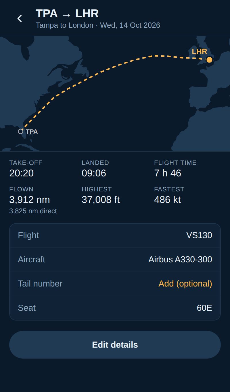
Each flight's own map Pro
The route you really flew, take-off and landing in local time, flown against direct distance, and the details you added.
- A globe view for polar and long routes
- Day and night drawn across the world
- Major cities labelled
- Stops by itself after landing
- Nautical miles, miles or km; feet or metres; °C or °F
- A demo flight to try it on the ground
GPS only listens, so it works in flight mode
Before you board
Set your arrival airport and download the weather reports while you have internet. Everything else, including the world map, is already in the app.
On board
Tap Start and switch to flight mode as usual. Your phone's GPS only receives signals from satellites, so flight mode doesn't stop it. Put the phone away; it records with the screen off.
After landing
It notices the landing and stops by itself, so it isn't using battery in your pocket at the other end. With Pro, the flight goes into your logbook.
What it can't do, up front
A phone GPS in a metal tube has real limits. Here they are, so you know what to expect.
Android 8 or later. There's no iPhone version yet.
Satellite signals come in through the windows. Away from them, the phone may find too few satellites for long stretches. The app then estimates your position and shows how sure it is, but the estimate can be tens of miles out.
On many phones (Samsung's Power saving, for example) battery saver switches the GPS off when the screen is off. The app warns you; turn it off for the flight.
About 3 to 4% of the battery an hour in our tests, less with the screen off. A long-haul flight can take a quarter to a third of a full charge.
Turbulence and airport reports aren't updated in flight unless you're on the plane's Wi-Fi. They're warnings for areas, not a forecast for your flight.
Arrival time comes from your ground speed and distance, without the winds ahead or the airline's schedule, so it can be several minutes out, more early in the flight. Height is GPS height and can differ from the cabin screen by a few hundred feet. It's not a navigation aid.
Countries, coastlines, seas and major cities. No roads, terrain or satellite pictures, which keeps it small and offline.
Use it as you'd use any phone on board: in flight mode, and when the crew allow phones.
Your first flight is free
Your first flight costs nothing, with every core feature. After that, Unlimited is a one-off payment for every flight, for ever, and Pro adds the logbook and more. No subscriptions, no adverts.
Free £0
- Your first flight, with every core feature
- Live position, height, speed and heading
- Arrival time, time and distance to go
- Turbulence, storms and arrival weather
- Estimated position when the GPS drops out
- A bonus flight when you send us feedback (coming)
Unlimited £3.99 one-off
- Everything in Free
- Every flight, for ever
- Trips with connections and layovers
- No subscription, no adverts
Pro £7.99, or £4.99 from Unlimited
- Everything in Unlimited
- The logbook: every flight, stats and records, export to a spreadsheet
- Export routes to GPX and KML (coming)
- The real route over the ocean when the GPS drops out (coming)
- Live aircraft, and where your plane is before you board (coming)
Launch prices on Google Play, in pounds; other currencies are set by Google. Testers get Pro free: unlocked during the test, and kept after launch. How to join.
Your position stays on your phone
- Nothing sent to usYour positions, routes, trips and logbook are stored only on your phone. We don't run any server that the app talks to.
- No account, ads or analyticsNo sign-up, no advertising, no usage tracking, no tracking across apps.
- Only public reports downloadedThe app downloads public weather reports from the US Aviation Weather Center. It sends the airport codes of your trip, never your position.
- Your log, your choiceThe app keeps a log of its own activity on your phone for 7 days. It leaves your phone only if you share it yourself.
- Delete everythingClear the route, log or logbook in the app, or uninstall it to remove everything.
- No selling or sharingWe don't sell or share data. If optional anonymous statistics are ever added, they'll never include your position, and the policy changes first.
The full privacy policy lists every service the app contacts.
Help us launch it
Flight Map is in a closed test on Google Play. We're looking for Android users with flights coming up to take it on board and send us the logs. Testers get Pro free, during the test and after launch.